For me, the magic of SoilWeb begins with its GPS link. You're standing in a field, you tap your smartphone screen on the Get Soil Data button of the app – and voila – up pops a "picture" of the ground beneath your feet.
Today, for example, I pulled out my phone while walking on a farm, called up the app, and tapped the screen. I quickly learn I'm standing on a soil comprised 80% of a Conejo loam, a series of "very deep, well drained soils…." There are four other soil types in the mix here, and from each of the five illustrations of their profiles I can drill down to deep levels of soil survey information, including land classification, hydraulic and erosion ratings, soil suitability rating, flooding frequencies, and more. Decision making can begin for a soil's suitability for farming practices and placement of septic systems, ponds, roads, and other land uses.

SoilWeb offers a lot of highly technical data. But I don't think you have to be a soil scientist to find this app amazing, and it's hard to imagine why any farmer or landowner wouldn't want this level of info about the basic stuff of their livelihood at their fingertips. For farmer advisers, the tool would seem to be invaluable as a starting point for any advice. I simply enjoy using the app while traveling farm country backroads.
The related, Web-based tools from the soils team at the University of California-Davis, in collaboration with USDA-NRCS, are complementary to the smartphone app, offering additional ways to view soils information for locations throughout most of the U.S.
The recently revised SoilWeb app has been popular. Since SoilWeb 2.0 was launched in June 2019, the app and web-based soil survey tools have received some 4,000 unique queries daily, according to USDA.
The updated SoilWeb app is available as a free download on Google Play and Apple App Store. The web-based Soil Web tools compatible with smartphones, tablets, and desktop computers are available at the University of California-Davis Soil Resource Lab. Link: https://casoilresource.lawr.ucdavis.edu/soilweb-apps/.
Interviewing the inventor
Given the new developments with SoilWeb, I recently spoke with one of the co-developers, Anthony O'Geen, a professor and researcher at the University of California-Davis Soil Resource Lab.
In the course of several email exchanges, I showed him a soil map from my own farm to see what I further could learn from the Soil Survey data that's been available for many decades now, but not easily accessible — until SoilWeb.
Soil surveys were begun in the 1890s. What do you think have been the biggest advances in soils information over, say, the last 50 years?
Nothing much has changed over the years in terms of the soil survey inventory. What has changed most is the way it's presented to the public. In the past, soil survey was distributed in printed form. These were fairly cumbersome documents where a user would have to find a location within the maps, identify the map unit and then look up the data in a series of tables for the corresponding map unit. So the data was difficult to summarize.
Of all the data one can discover with the SoilWeb apps, what do you think farmers would find of greatest practical value?
That's difficult to say because every landscape has its own set of capabilities and limitations. Generally speaking, the soil properties are most valuable because they can be used to guide the grower's problem-solving efforts, for example, how soil properties influence native fertility, erodibility, water relations, etc. These properties (chemical, physical) are the basis from which soil survey interpretations, such as the Land Capability Classification System, and suitability for different land uses, are built.
What work at the Soil Resource Lab is most interesting to you currently? What's new?
Recently we have been working on cross-communication among our apps. You will note that SoilWeb has links to the Soil Series Extent Explorer, the Soil Data Explorer tool, and the Web Soil Survey.
We are also trying to repackage soil survey into Soil Health Regions, the idea being that soils have different sets of soil health indicators, and these groups respond differently to soil health practices. We are trying to create soil health regions in California so that we can create accurate diagnoses of soil health and prescribe the right practices to improve health.
I'm intrigued by the new state and national maps that depict soil color. What can one learn from the color of soil?
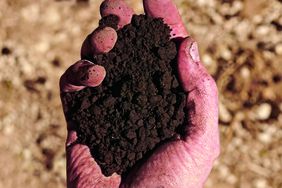
These are mainly pretty pictures that convey soil diversity. But color is a result of soil-forming processes. Dark colors come from soil organic matter decay, brown and orange colors from well-drained conditions, blue grey and green often reflect poor drainage, and light colors are highly leached or could be salts.
So the "pretty pictures" aren't of much practical value?
Color is most useful as a site-level observation, not as a map. Soil survey map units consist of more than one soil type (different colors), so the maps themselves are a bit misleading. Plus, we've aggregated map units to make these maps.
However, color at the field scale as a primary observation is very telling. It can show erosional patterns, it is a direct indicator of drainage condition, can be used to identify certain types of salts, and it can help us understand how soils change across landforms.
With that said, the maps of color are my favorite, because they show how amazing soils are and how diverse they can be.
Given the new interest in carbon banking, how can soils information, including the data your apps provide, inform the process?
The cart is ahead of the horse in terms of knowing how much carbon a specific soil can hold or stabilize for long periods of time. However, we know there are environmental conditions that influence how much soil organic carbon a soil can retain. For example, drainage, climate, slope, texture, and mineralogy influence how much carbon a soil can sequester. Soil survey can help us make general comparisons — which soils have higher potential or lower potential, but it's difficult to put numbers on it.
Can you elaborate on what you mean by the "cart before the horse?"
Well, a lot of people think that if you add carbon to soil then you will sequester it. While it is true that soils are the largest terrestrial stock of carbon, that carbon is at steady state with the environment…inputs = outputs + stored C. That is, if you add more C, more will also be combusted by microbes into CO2, and possibly more will be stored, but every soil likely has a carbon saturation point, and we don't know what that is. And if one stops adding C to soil, it will eventually go back to its steady state.

Looking at a SoilWeb-generated image of my farm, 160 acres in Nebraska, what soils story does this picture tell you?
The taxonomic diversity is fairly high for such a small area, but the soil properties seem relatively uniform compared with other parts of the country. So I guess I'd say that differences in soils there are relatively minor. It's the susceptibility to erosion that seems to be driving the differences.
The taxonomy of these soils suggests it was a grassland soil, a rich soil that has high native fertility, high organic matter, and good characteristics within the rooting zone. The timing of rainfall generally coincides with that of the growing season, unlike out here in the West.
Looks like all the soils are well drained, even most of the soils in the lowlands. About half of your land is prime farmland, and the other half has fairly serious limitations mainly due to erodibility.
All these soils have a large reservoir of plant available water. Soil organic carbon stocks are high relative to soils on the West Coast. Some soils have a slightly high shrink-swell potential; subsoil pH values are fairly high and may induce some nutrient deficiencies. At a glance, the soil texture of all the soils and their horizons is ideal for plant growth, but again also highly susceptible to erosion.
What do you see here in terms of soils that might inform our future land management? (Currently, only the southeast corner is planted in row crops. The rest is pasture, prairie hay, pollinator habitat, and Conservation Reserve Program grass mixes.)
Given that these soils are highly prone to erosion, what you're doing now seems like a great approach. If other perennial crops take hold in the future for your area (that can maintain soil cover) then that may be a new future depending on how the climate changes there.
I like the idea of small farms obtaining multiple lines of income through various ecosystem services: pollination zones, stable carbon zones, biodiversity zones, but we need to monetize ecosystem services.
Practices that maintain a stable carbons stock will be the future. Maybe you have some potential to integrate short intervals of grazing within a cropped area at the right times to boost income? Maybe you'll grow perennial grains once they are improved?
Looks like a great spot for a farm.
For more information on soil health and other conservation topics: Birdlandfarm.com.

