:max_bytes(150000):strip_icc()/indiana508661173-Large-56a5fef05f9b58b7d0df6458.jpg)
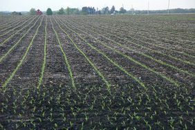
A drier week in the eastern half of the Corn Belt coincided with strong planting progress in states like Indiana, Ohio, and Pennsylvania. For the second straight week, the U.S. Department of Agriculture’s (USDA) Crop Progress report showed Pennsylvania jumped 20 percentage points in corn planting, going from 70% to 90% complete as of June 9 and getting back in line with the five-year average of 89%.
Indiana benefited from 5.2 days of suitable fieldwork and precipitation numbers of 0.42 inches — 0.55 inches below normal — to move up to 94% complete with corn planting and three percentage points above the five-year average of 91%.
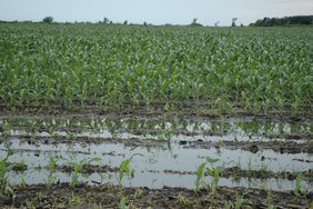
The USDA’s National Agricultural Statistics Service (NASS) said “Despite the excessive rainfall this planting season, uniform emergence was reported on most fields and only some fields required replanting,” a good sign for the state and for the larger area after a spring in which the state received substantial rainfall compared with seasonal averages.
An Iowa Environmental Mesonet map of Indiana from March 1 through May 31 showed much of the northern two-thirds of the state were 2-plus inches above seasonal precipitation averages. Areas like Howard, Miami, and Cass counties in north-central Indiana experienced over 6.2 inches of precipitation above the average for the three-month period.
:max_bytes(150000):strip_icc()/d_sector__sector_IN__network_WFO__wfo_IND__var_precip_depart__gddbase_50__gddceil_86__date1_2024-03-01__usdm_no__date2_2024-05-31__p_contour__cmap_RdYlBu__c_yes__ct_climate51___r_t__dpi_100-63e13becbfeb4086b01c9dd14a3bb6eb.png)
Iowa Environmental Mesonet
Short-term forecast
The next 10 days may be the warmest week of the year for much of the Corn Belt, according to the National Weather Service’s Climate Prediction Center. The most recent forecast, released June 10, has areas from Nebraska and Kansas all the way to North Carolina with a high probability of higher-than-average temperatures.
The eastern portion of the Corn Belt from Illinois to Pennsylvania is projected to have a 70% to 80% chance of above-average temperatures from June 18-24, although there is also projected to be no change from the yearly average in precipitation in the same time period.
:max_bytes(150000):strip_icc()/814temp.new1-c686bc5015f14156ae8e590e62686b84.jpeg)
National Weather Service
AccuWeather meteorologist Brandon Buckingham also confirmed the high temperatures headed for the eastern U.S. after the weekend.
“From Monday through much of next week, homegrown high pressure will build over the region while the jet stream bulges northward,” Buckingham explained. “This one-two combination will set the stage for building heat and an uptick in humidity levels. For many, this will be the first heat wave of the year.”
Longer-term forecast
When talking about weather forecasts for the Corn Belt later in summer, Iowa State Climatologist Justin Glisan mentioned the ‘neutral’ weather period right now as the United States transitions from an El Niño to a La Niña later in the summer and into the fall.
He said there’s an “elevated signal” for warm temperatures in June, July, and August, but there is no clear indication one way or the other on precipitation.
“When we look at those summers of a shift to La Niña, we’ve had wet summers and we’ve had dry summers,” Glisan said. “So, equal chances right now in terms of precipitation behavior.”
National Weather Service
The Climate Prediction Center agrees, with its latest three-month extended forecast predicting a high likelihood of above-average temperatures across much of the Corn Belt. The precipitation forecast is less clear, but areas of Indiana, Ohio, Pennsylvania, Kentucky, and North Carolina in the eastern Corn Belt are currently predicted to have more precipitation than usual over the next 90 days.
National Weather Service
:max_bytes(150000):strip_icc()/D3_6937-2000-cbc088ead7fc464f94999b4660b03bb7.jpg)
