:max_bytes(150000):strip_icc()/FloodedCornField2-MediumShot-2000-c037576e58db4c9cb0e5ebb7cd98df3b.jpg)
June was an all-time wet month for Minnesota farmers.
According to the Minnesota Department of Natural Resources Climate Journal, June 2024 was the fourth-wettest June on record in the state and the fifth-wettest month in recorded Minnesota history. The National Oceanic and Atmospheric Administration (NOAA) reported the average June rainfall throughout the state was 6.78 inches.
Kenny Blumenfeld, senior climatologist for Minnesota, said a stretch in the middle of the month contributed heavily to the large rainfall totals.
“In addition to a persistent, active pattern, we got stuck in an eight-day pattern where it just rained really, really hard,” Blumenfeld said.
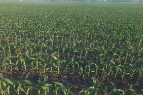
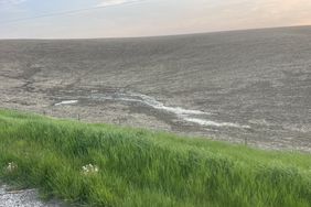
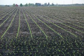
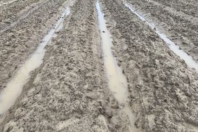
The impact of the consistent heavy precipitation has been stark, with flooding happening throughout the state. A June report from CBS News said nearly half of Minnesota was in flooding conditions because of high water levels on the Missouri, Minnesota, and Mississippi rivers. Blumenfeld said that even before heavy June rains, there were reports of flooding in agricultural areas that resulted in equipment being submerged in some fields.
:max_bytes(150000):strip_icc()/d_sector__sector_MN__network_WFO__wfo_MPX__var_precip_depart__gddbase_50__gddceil_86__date1_2024-06-01__usdm_no__date2_2024-06-30__p_contour__cmap_RdYlBu__c_yes__ct_climate51___r_t__dpi_100-e05161ffb9a444ec883f844c48377a72.png)
Iowa Environmental Mesonet
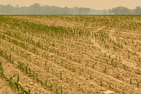
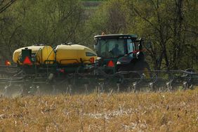
In the U.S. Department of Agriculture (USDA) Crop Progress report released on July 8, Minnesota only had 2.9 days suitable for fieldwork during the first week of July. A state-specific report said, “Heavy rain and saturated soils continue to restrict access to fields throughout much of the state. Some livestock losses were reported due to flash flooding.”
Blumenfeld said there has been difficulties for farmers with the sheer amount of rainfall and subsequent floods.
“I took a drive because I was giving a talk to an ag group in June during the wet spell,” Blumenfeld said. “I lost count after I got to 15 different flooded farm fields on a stretch two hours west of the Twin Cities.
“Not every producer, not every farmer in the state, but certainly quite a few in southern Minnesota have had some difficulties because of very wet fields. Even if they have tile drainage, it was too wet for the tiles to shed effectively.”
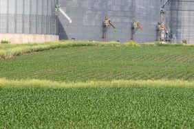
USDA’s most recent Crop Progress report said Minnesota was up to 4.7 workable field days as of July 14. Corn and soybean conditions have been steady, with 58% of corn in good/excellent condition and 58% of soybeans in good/excellent condition.
Corn silking is at 16%, 8 percentage points behind the five-year average of 24%. Soybeans are also blooming slower than the five year average of 51%, with progress at 46% as of July 14.
Data from the Iowa Environmental Mesonet from June 1 to June 30 shows a higher surplus of precipitation in the western half of Minnesota. The hardest hit area, according to the map, was the southern tip of Minnesota, where areas experienced upwards of 10 inches more rainfall than the average.
What’s next?
Blumenthal said farmers in the state are weary of returning to drought-like conditions like those in 2023, and are hesitant for rain to stop completely.
But, he said, a return to “stability” would be welcome for the rest of the summer.
The July outlook from the National Weather Service‘s Climate Prediction Center (CPC) has Minnesota still more likely to receive more precipitation than the yearly average and neither high nor low temperatures. This is in stark contrast to most of the Corn Belt, which has experienced multiple large-scale heat waves already through the first half of the month.
:max_bytes(150000):strip_icc()/off01_temp2-b7d60b033b9b4d0db7555f83604c7441.jpeg)
National Weather Service
Long-term forecasts and predictions from the CPC actually have Minnesota as likely to experience above-average temperatures through the July-August-September period. Precipitation outlooks put the state as middle of the road with no clear indications of dry or wet conditions.
:max_bytes(150000):strip_icc()/off01_prcp2-7ffc2de6e5014486b2c6fa06324aa65b.jpeg)
National Weather Service
:max_bytes(150000):strip_icc()/D3_6937-2000-cbc088ead7fc464f94999b4660b03bb7.jpg)
