:max_bytes(150000):strip_icc()/Wet-farm-field-western-Iowa-May-2024-Kelly-Garrett-2a0b7ddf3d1c43cfa437c534425b9fce.jpeg)
XtremeAg
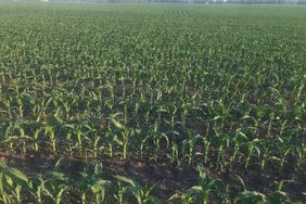
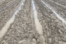
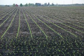
Iowa is coming into June after a very wet month of May with most of its corn crop in the ground. Despite May being one of the top-10 wettest months in Iowa history, the U.S. Department of Agriculture’s (USDA) latest Crop Progress report says 93% of Iowa corn has been planted, two percentage points behind the five-year average of 95%.
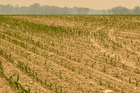
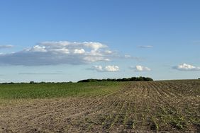
In some areas of the state, though, conditions are varied in fields due to consistent heavy rainfall. Multiple regional agronomists at Iowa State University Extension reported issues with getting corn in the field, having to replant the crop, or issues with emergence early in the growing season.
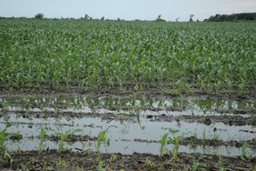
Leah Ten Napel, an agronomist based in northwest Iowa, said massive rain has led to ponding issues.
“In the last month my region has received 6 to 11 inches of rainfall. Because soil profiles were already near or at field capacity, this is causing some ponding issues,” Ten Napel wrote. “Growers should wait three to five days after water has receded to assess damage. If the corn growing point is soft and darkened, or the soybean’s growing points are showing no new growth, a decision should be made.”
In some parts of the state, such as agronomist Aaron Saeugling’s base in southwestern Iowa, several fields have been forced to replant corn and soybeans due to damage from hail, rain, and severe storms. He also reported some ponding in lower fields and said soybeans are still yet to be planted on some farms.
In addition, he said “Spraying corn has been a challenge as well as some nitrogen loss in saturated portions of the field.”
:max_bytes(150000):strip_icc()/d_sector__sector_IA__network_WFO__wfo_DMX__var_precip_depart__gddbase_50__gddceil_86__date1_2024-05-01__usdm_no__date2_2024-05-31__p_contour__cmap_RdYlBu__c_yes__ct_climate51___r_t__dpi_100-d2206b41d99045f8a6e8c505cec2d0d4.png)
Iowa Environmental Mesonet
According to the Iowa Environmental Mesonet, pockets of northern Iowa received up to seven inches more precipitation than the state’s average for May. Only the very southeastern corner of the state was under its average precipitation.
Short-term forecast bringing the heat
The latest USDA Crop Progress report also included weather information from Iowa State Climatologist Justin Glisan, who said the week ending June 2 was the first in “several weeks” to not have the majority of Iowa experiencing greater-than-average precipitation.
After thunderstorms rolled through the state Tuesday evening and dropped heavy rain, Iowa is looking at a hot and dry forecast for the next two weeks, according to the National Weather Service’s Climate Prediction Center.
:max_bytes(150000):strip_icc()/814temp.new-b2db519608764faa9aa6e0fc7476c4c9.jpeg)
National Weather Service
The Climate Prediction Center predicts Iowa to lean toward warmer temperatures than average from June 12 to June 18, and for rainfall levels to be near normal. Temperatures are expected to remain high for the rest of the month compared with the state average.
Extended outlook
Extended outlooks for the state and for much of the Corn Belt predict warmer temperatures through June, July, and August, but northern Iowa was given equal chances of warmer or colder temperatures than average for the same period.
Precipitation for the same time period is predicted to be in line with the yearly average for the summer stretch throughout Iowa, as the neutral period slowly turns into a La Niña ahead of harvest season.
:max_bytes(150000):strip_icc()/off01_temp1-13dbe0661e0c4f6b907288679a9e850b.jpeg)
National Weather Service
:max_bytes(150000):strip_icc()/D3_6937-2000-cbc088ead7fc464f94999b4660b03bb7.jpg)
